
Editor’s note: The COVID-19 global pandemic has urged companies around the world to focus their attention on providing for the health and safety of their employees and preparing their organizations for a period of disruption. On top of our regular articles examining the longer-term issues and trends impacting organizations, The One Brief will also bring our readers insights into the current situation.
OVERVIEW
In the little more than six decades since Sputnik was launched into space, satellites have gone from the stuff of science fiction to an integral part of everyday life.
They have changed the way we communicate, navigate and even dress each morning. Satellite communication has linked the world, making remote areas less remote. And as we try to overcome the impact of climate change, they are providing valuable data to help guide the effort.
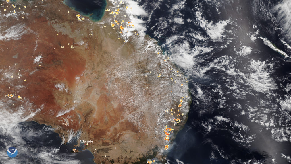
As technology advances, satellites have gotten less expensive, smaller and ever more sophisticated. Satellites are tracking the slowdown of economic activity during the COVID-19 crisis, evidenced by changing patterns of nitrogen dioxide seen from space. They have also proved invaluable in an emergency: satellite photos and other images gave a clear picture of the extent of Australia’s wildfires.
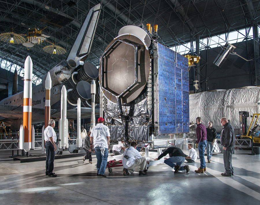
Over the years, the private sector has joined the space race, with organizations launching their own orbiters.
“Satellites provide a perspective that simply isn’t possible on the ground and data that can lead to new insights and better decisions here on Earth,” says Jeff Poliseno, chief executive officer of International Space Brokers at Aon. “Those insights are critical to solving many of the most complex problems we currently face and improving the quality of our lives.”
IN DEPTH
Satellites play an important role in our everyday lives, from our first check of the weather forecast in the morning to watching a nightly news report of an event across the globe.

Shrinking The World By Improving Communication
Growing reliance on the internet has shaped our expectations for how – and how fast – people are able to communicate with others.
“The demand for data is increasing exponentially – everyone wants unlimited data plans for their smartphones and high-speed internet for streaming services in high definition,” observes Jared Ball, chief technology officer International Space Brokers at Aon. “To support those demands, we need the right infrastructure in place. That means building out the cellular network. But you need satellite services to back up those cellular services and then provide connectivity.”
Investment in 5G technology is rising to meet demand for providing devices with more data at greater speeds and lower latency, powering activities from high-frequency trading to gaming. Aerospace companies are also building “mega constellation” infrastructure, with the goal of providing high-speed, high-bandwidth internet access globally. At a time when internet access has become key in keeping up in the modern economy, satellites make it possible to offer service in remote areas. Nonprofit organizations aim to increase international parity of internet access and promote economic growth in developing countries by tapping into existing satellite infrastructure.
Guiding Transportation And Logistics From Earth’s Orbit
Satellites are vital to smart transportation and logistics systems. Information from GPS helps guide autonomous vehicles as well as buses and freight trucks – and soon ships. And GPS satellites help businesses (and their customers) better track shipments: among other things, tiny devices connected to communications satellites help track shipping containers and other assets in transit.
On the road, satellite data helps drivers choose alternative routes due to changing weather conditions, accidents or traffic congestion.
Satellite information can also help municipalities make decisions on infrastructure maintenance, particularly in remote areas. For example, Alaska officials are monitoring the condition of infrastructure using satellite imagery across the vast state.
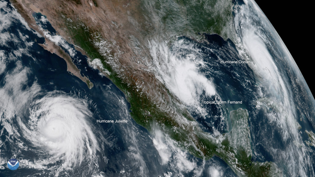
Improving Weather Forecasting And Natural Disaster Response
Weather satellites are an important element of forecasting, supplementing information collected from land-based systems.
“As satellite technology becomes more granular and precise, this data is critical in helping to better understand and prepare for weather events, such as tropical cyclones,” says Steve Bowen, meteorologist and head of Catastrophe Insight at Aon. “Improved data allows us to better track where a storm is headed and alert those in its path. The forecast ‘cone of uncertainty’ has gotten smaller in recent years as the technology improves, allowing us to make more exact decisions and warn people of potential risks earlier than ever.”
Imagery from satellites can help governments, nonprofits and other emergency responders following natural disasters such as earthquakes, hurricanes, floods, droughts and volcanic eruptions. They can also help maintain communication after a catastrophe when cellular networks and landlines fail.
“Satellite data allows us to grasp the extent of damage after a natural disaster so we can design the safest, most effective rescue and recovery efforts,” says Anthony Meyers, director of analytics at Aon, adding, “Satellite-based analytics can also help minimize fraudulent insurance claims by decreasing the loss-to-notification timeline for the ultimate benefit of all plan holders.”
As wildfires grow more frequent and more destructive, NASA’s Fire Information for Rescue Management System distributes fire data from satellites in near real time to natural resource managers.
Managing Challenges For The Commercial Sector
Morgan Stanley estimates that commercial space will be a $1.1 trillion industry by 2040. Indeed, private-sector space projects are on the rise: according to Poliseno, companies looking to tap into satellite services can either lease capacity from an operator with satellites already in orbit or buy, launch and protect their own equipment. Both routes can bring challenges.
“Risk transfer is critical for launch projects. Many lenders require insurance coverage, especially for firms with less capital,” notes Ball. “Given the long timelines on launch projects, the current hardening insurance market may have an impact on projects two or three years down the road.”
For satellite operators competing for lessees, staying on top of technology’s evolution is a differentiator, but poses a challenge for equipment orbiting in space.
“A traditional satellite provides services to a fixed geographic area on Earth from a particular point in space that it operates from, and it’s difficult to change the service area and orbital location without relaunching another satellite,” notes Ball. This would be a roadblock for a satellite operator who decides they want to change their service area, for example, from North America to Africa. “But operators with newer satellites have functionality called ‘beam forming’ that offers more flexibility to change orbital locations and coverage areas to meet changing customer demands.”
And for many companies, costs go beyond the satellites themselves: to draw insights from satellites, the huge volumes of data they deliver require additional investment. “The tech to process all that satellite imagery can be onerous and costly to implement,” says Meyers. Even with the proper technology in place, firms are finding it difficult to find the right people to fill these data science roles.
Philosophical questions around satellite technology have also begun to emerge. “Privacy concerns are very real and need to be considered carefully,” Meyers adds. “And from a regulation standpoint, there is no predefined or even testable standard framework for the models that leverage satellite data. There’s still work to be done around ensuring they are built and used properly.”
Finally, as the number of satellites in orbit grows, the growing amount of space junk does pose risks to equipment for both owners and operators. It raises questions about companies’ and governments’ liability for finding solutions beyond Earth.
From High Above Us, Satellites Improve Our Everyday Lives
Satellites have become an essential part of modern life – and a tangible example of technology’s role in advancing our society.
As satellites continue to advance technologically, the data they gather and communication they facilitate will power better decision-making, new business opportunities and an improved quality of life on Earth.
The post Satellites: Insights From Space, Decisions On Earth appeared first on The One Brief.